Trail 404, AZ revisited
#1
Trail 404, AZ revisited
Westy and I decided to head back out to the Camp Creek area and try to tie in a unexplored technical side canyon with Trail 404 and then on to the Verde. We had originally hoped to cross the Verde and tie this all in with Log Corral... but the big river only allowed one crossing, and we needed a few more to make it all work.
Saw a Gila monster in the creek right of the bat. A rare find, even in AZ.

First obstacle into the tech section was pretty tight...

Sure it will fit... well, pretty sure... well, just go slow

Westy flexing through

Encroaching foliage (I swear there is a trail here)

We walked up the creek to get an idea how doable the unknown tech sections where going to be. Both looked possible, so we decide to give them a try.
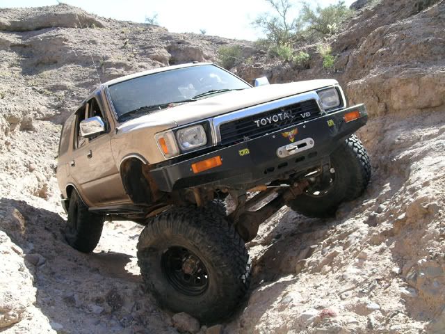
Entering first obstacle
Westy on the same
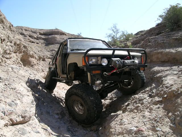
Bit off camber with an aggressive twist... but traction was stout
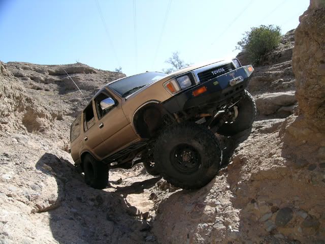
Westy needs only one rear wheel

Hmmmm.... no way to back up now
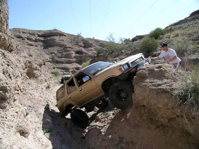
The golden line
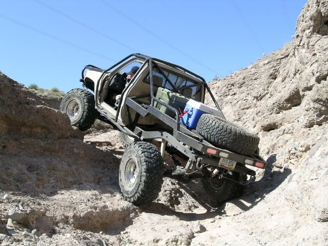
Entering section two
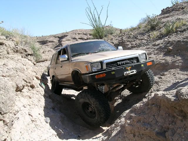
Westy at the same spot

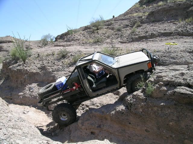
Sure didn't look that steep before

I'd like to personally thank Marlin for this controllable wheelstand

Westy makes it look a little too easy
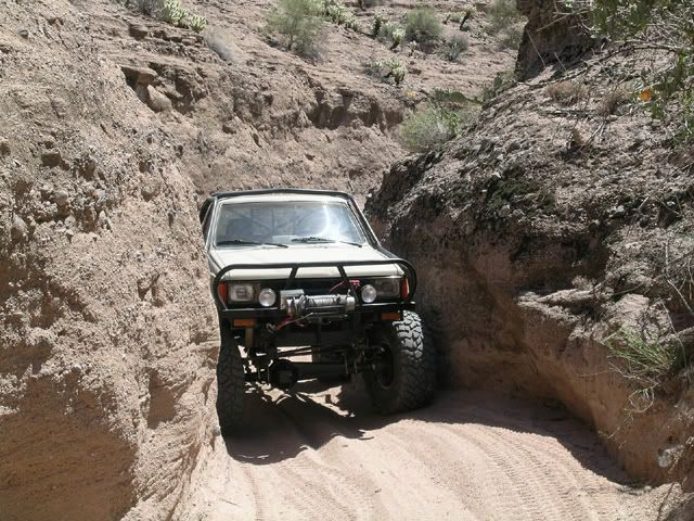
Trail 404 has this amazingly tight box canyon. How tight? If Westy was 1" wider at the tires he would still be wedged in there as I type this.
"Oh man... you've got plenty of room... quit your whining!!"

Assessment of vehicle width has never been one of my strong points.
This section feels like a mini version of Lions Back. Very mini, but still fun

Finally made it to the Verde. Was a great way to go as a slot canyon just ends right at the bank. Girlfriend tested the waters depth. (I'll have to keep her around )
)
I crossed first... no issues

Westy followed just as easily
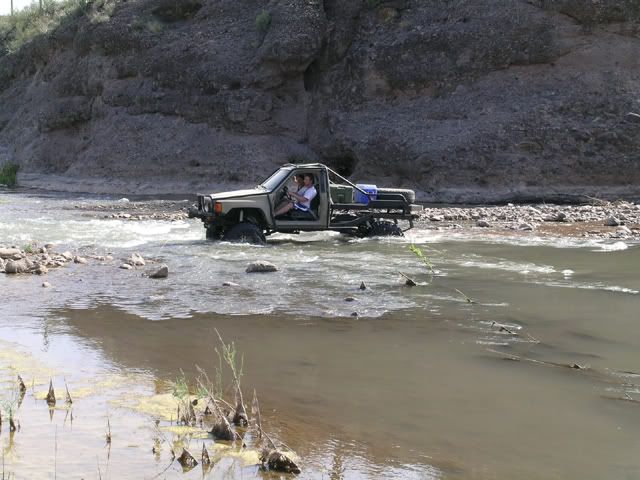
After screwing around trying to find a route to Log Corral, we were defeated by the water level and returned to civilization.
Parting shot

All in all it was a great day with some very tight trails with amazing views. The desert is close to full bloom. For the locals... get out there and enjoy it before things get to hot.
Saw a Gila monster in the creek right of the bat. A rare find, even in AZ.

First obstacle into the tech section was pretty tight...

Sure it will fit... well, pretty sure... well, just go slow


Westy flexing through

Encroaching foliage (I swear there is a trail here)

We walked up the creek to get an idea how doable the unknown tech sections where going to be. Both looked possible, so we decide to give them a try.
Entering first obstacle

Westy on the same

Bit off camber with an aggressive twist... but traction was stout

Westy needs only one rear wheel

Hmmmm.... no way to back up now

The golden line

Entering section two

Westy at the same spot

Sure didn't look that steep before


I'd like to personally thank Marlin for this controllable wheelstand


Westy makes it look a little too easy

Trail 404 has this amazingly tight box canyon. How tight? If Westy was 1" wider at the tires he would still be wedged in there as I type this.
"Oh man... you've got plenty of room... quit your whining!!"


Assessment of vehicle width has never been one of my strong points.

This section feels like a mini version of Lions Back. Very mini, but still fun

Finally made it to the Verde. Was a great way to go as a slot canyon just ends right at the bank. Girlfriend tested the waters depth. (I'll have to keep her around
 )
)I crossed first... no issues

Westy followed just as easily

After screwing around trying to find a route to Log Corral, we were defeated by the water level and returned to civilization.
Parting shot

All in all it was a great day with some very tight trails with amazing views. The desert is close to full bloom. For the locals... get out there and enjoy it before things get to hot.

Last edited by Elvota; 04-08-2007 at 07:39 AM.
#5
Wow, I would crap myself during some of those ascents. I'm alway worried stuff will roll under waaaay milder conditions. Looks awesome, maybe someday I'll be willing to put my runner through this kind of ringer. Good pics!
#7
We might have been able to ford again, but we would have had to cross 3 more times to make this particular route work. Although, I have been looking online through some satellite shots and believe I have found another way to link to Log Corral with only 1 river crossing.
Trending Topics
#8
The river depth stopped the progress. Where we crossed the first time was wide enough to drop the water level. Upstream the banks get narrow and steepen, making the water deeper and faster.
We might have been able to ford again, but we would have had to cross 3 more times to make this particular route work. Although, I have been looking online through some satellite shots and believe I have found another way to link to Log Corral with only 1 river crossing.
We might have been able to ford again, but we would have had to cross 3 more times to make this particular route work. Although, I have been looking online through some satellite shots and believe I have found another way to link to Log Corral with only 1 river crossing.

#10
I've been using mostly the MapQuest aerial view, but have heard great things about Google.
I just type in the nearest intersection to the trails and start scrolling. I only get a fuzzy image if I scroll well into the wilderness. I don't now how it compares to Google, but I have found tons of trails and washes that would have taken forever to link together on the ground.
You'll have to let us know when you get rolling. The more the merrier.
And Westy is the benchmark for making the "Squeeze" section. I can't imagine anyone being wider and still making it through.
I just type in the nearest intersection to the trails and start scrolling. I only get a fuzzy image if I scroll well into the wilderness. I don't now how it compares to Google, but I have found tons of trails and washes that would have taken forever to link together on the ground.
You'll have to let us know when you get rolling. The more the merrier.

And Westy is the benchmark for making the "Squeeze" section. I can't imagine anyone being wider and still making it through.

Last edited by Elvota; 04-09-2007 at 02:07 PM.
#12
I've been using mostly the MapQuest aerial view, but have heard great things about Google.
I just type in the nearest intersection to the trails and start scrolling. I only get a fuzzy image if I scroll well into the wilderness. I don't now how it compares to Google, but I have found tons of trails and washes that would have taken forever to link together on the ground.
You'll have to let us know when you get rolling. The more the merrier.
And Westy is the benchmark for making the "Squeeze" section. I can't imagine anyone being wider and still making it through.
I just type in the nearest intersection to the trails and start scrolling. I only get a fuzzy image if I scroll well into the wilderness. I don't now how it compares to Google, but I have found tons of trails and washes that would have taken forever to link together on the ground.
You'll have to let us know when you get rolling. The more the merrier.

And Westy is the benchmark for making the "Squeeze" section. I can't imagine anyone being wider and still making it through.

I was concerned if I would have any inssues through there, I am wider than stock.
Thread
Thread Starter
Forum
Replies
Last Post
primordialbeast117
86-95 Trucks & 4Runners
11
12-19-2015 12:23 PM
83yotastockR
86-95 Trucks & 4Runners (Build-Up Section)
11
11-10-2015 06:54 AM
JookUpVandetti
86-95 Trucks & 4Runners
10
09-30-2015 08:58 AM
Toys4parts
86-95 Trucks & 4Runners (Build-Up Section)
2
09-26-2015 01:56 PM


